TAG: vector, elevation, prettymap, databases, population, country, areas, program, ,  vector map, map databases,
Best Search Category: pc diagnostics, speed up pc, computer speed, pc booster, registry cleaner window xp, performance optimize, pc performance check, pc utilities, pc performance software, computer diagnostics software, fix pc software, computer diagnostic software, computer diagnostic tools, pc repair software, pc repair softwares
PrettyMap

License / Price:
Shareware / 24.95 $
Category :
Home & Education / Others
Requirements :
Publisher / Limitations:
Capstone /
Size / Last Updated:
1587KB / 2008-03-21
TAG: vector, elevation, prettymap, databases, population, country, areas, program, ,
vector map, map databases,
Operating System:
Palm OS 5.0,  Palm OS 6.0
Download:
Download
Publisher's description - PrettyMap
Rate


12 Ratings  
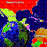
  View maps of Earth and other planets with PrettyMap! See current day and night areas, learn geography with the quiz, enjoy 3D elevation surfaces, measure distances between locations and create your own maps with special places! PrettyMap lets you view vector and raster maps and images (such as country boundaries, world cities, rivers, satellite photos), search in geographically-referenced data, visualize and analyze spatial information, extend your knowledge, and edit your own simple maps. PrettyMap is a GIS program with the following features:


- support for vector maps (points, lines, areas)

- support for raster maps (terrain elevation and bathymetry, images, symbolic)

- handles multi-attribute data associated with vector map objects

- displays maps of various planets

- free maps available:

* country boundaries with country names, capitals, population sizes, ...

* major cities with names, status, population ranks and classes, ...

* USA states with areas, population sizes, males, females, age, marriage, race, and household statistics, ...

* major rivers

* elevation data for Earth, Moon, Mars

* and many more!

- internet connection not required on your PDA

- various color schemes for elevation maps

- user-defined elevation colors

- zoom range from whole planet to meters

- shows day and night area, computes shadow length and sun/north orientation

- multiple, configurable vector map layers

- data search for vector map databases

- versatile quiz with teacher mode for vector map databases

- bar charts and color-by option for numeric features in vector map databases

- relief and 3D elevation (DEM) view with vector map overlay

- distance measurement

- integrated user-defined locations (Points Of Interest) editor, stores notes and values for each POI

- sessions to quickly save/restore program state

- adjustable water level for elevation data

- numerous settings to customize the program


Also see ...


...in Home & Education

1)    How to Treat your Mother
 Most mothers care for their families in a thousand little ways that we all tend to take for granted. Ten TinyCards with envelopes to print and ideas to say Thank You for the tender loving care we receive all year round....

2)    LingvoSoft Talking Dictionary English <> Hebrew for Palm OS 3.2.97
 ...

...in Others

1)    Spanish Translator
 Translate your English to Spanish Easily with this interactive translation tool...

2)    Hero's Journey Monomyth Software Program
 The Hero's Journey pattern (also known as the Monomyth) is the template upon which the vast majority of successful stories and Hollywood blockbusters are based upon. Our detailed deconstruction of hundreds of successful stories and Hollywood blockbusters has revealed more than 188 stages of the Hero's Journey that you need to know about... Hero's Journey, Monomyth, Software, Program, Storyteller, Story Structure, Screenplay Structure, Story Template, Screenplay Template, Story Theory, Screenplay...


Related tags:
Advertisement